|
Nouvelle-Écosse
Pour de plus amples renseignement communiquez avec:
Président- Tim Webster - Courriel: timothy.webster@nscc.ca
CTV News did a story on Cow Bay, Nova Scotia and the work being done. Tim Webster, CIG NS Branch Chair, provides a brief explanation.
To view the story https://atlantic.ctvnews.ca/video?clipId=1650124
3D Data Workshop - January 30-31, 2018
With the success of last year’s CIG-GANS Coastal Mapping Workshop at COGS, we have decided to host another workshop at COGS on Jan 30-31, 2018.
CALL FOR PRESENTERS AND EXHIBITORS: 3-D WORKSHOP, COGS JAN 30-31, 2018
https://gans.ca/event-2723944
This event will focus on the exciting and emerging field of 3-D technology. We are looking for presenters and exhibitors to discuss 3-D data collection (indoor and exterior), as well as new methods to process and analyze 3-D data and perhaps the most exciting is the new methods to visualize and use 3-D data, for example using augmented reality and virtual reality.
Please mark your calendars and plan to come to Lawrencetown Jan 30-31, 2018. We have been guaranteed good weather for the event so no worries about travelling at that time of year.
More information to follow. Please find the attached graphic to share with people and lets make this a memorable event. We are expecting local, regional, national and international speakers at the event and encourage you to please contact us about presenting, exhibiting & attending.
Regards
Tim Webster
Chair
April 2016
CIG NS Branch Chiar Tim Webster recently attended the Nova Scotia Community College COGS (Centre of Geographic Sciences) student awards night where he presented two awards from CIG.
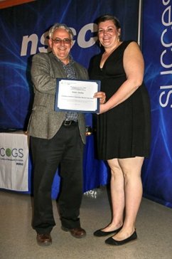 |
The Canadian Institute of Geomatics Membership Award, sponsored by the Canadian Institute of Geomatics, is a CIG one-year membership awarded to a Geomatics Engineering Technology graduate who demonstrates a keen interest in Geomatics. This award was presented to Kristin Sheffer. | The Canadian Institute of Geomatics (CIG) Nova Scotia Branch Award, sponsored by the CIG Nova Scotia Branch, is a CIG one-year membership awarded to an Advanced Diploma in Geographic Sciences - Remote Sensing Concentration graduate in good academic standing who is from the Maritime Provinces and has, or is expected to, contribute positively to the Geomatics community. This award was presented to Peter Dalton. | 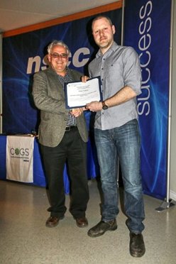 |
March 2015
NSCC’S Applied Geomatics Research Group will be hosting a Free 1-day workshop:
“The Results of the Topo-bathymetric lidar missions” Details
At the Baronet Ballroom, Delta Halifax, 1990 Barrington St., Halifax, NS
On Tuesday, March 3: 9:00 am – 4:00 pm
Complimentary Lunch & Refreshments
Using NSCC’s new Chiroptera II sensor, researchers from NSCC’s AGRG along with several project partners conducted the first Topo-bathymetric lidar missions in September 2014. . AGRG partnered with Leading Edge Geomatics for the airborne operations to survey nine study areas across Nova Scotia & New Brunswick testing a variety of applications in coastal and freshwater environments. We invite you to join us as we present the results of the missions and the benefits of this technology.
Please RSVP, we have a limited space!
Tim Webster, PhD
Research Scientist
Applied Geomatics Research Group NSCC, Middleton, NS
Email: Tim.webster@nscc.ca
September 2013
It is with great pleasure that I invite you to a Canadian Institute of Geomatics (CIG) seminar by Mr. Alex Golovko from MDL Canada located in Mississauga, Ont.
Title: “MDL Dynascan Mobile LiDAR”
Dynascan offers a unique solution in the mobile LiDAR scanning market. The use of a rotating laser head allows for full 360° scanning with no ‘blind spots' and the lack of internal moving parts is inherently very robust, a great advantage in rugged terrain and marine applications. With 1 cm and 5 cm laser accuracy versions and the compact incorporation of leading GNSS and IMU technology Dynascan offers a unique blend of performance, portability and price.
The seminar will briefly touch upon the MDL Canada operations, laser systems, modules and will mainly focus on the Dynascan laser mobile mapping system from MDL.
Each attendee will have an opportunity to sit in the company truck and see the way the Dynascan works and collects field data.
Presented by: Mr. Alex Golovko, Business Development Manager, MDL Canada
Mr. Golovko is currently the Business Development Manager with MDL Canada ( http://www.mdlcanada.com ) – 2012 – present, prior to that he was with Inside and Outside Sales with Laser Technology ( http://www.lasertech.com/ ) – 2001 – 2012. He obtained a Master of Technology Management – University of Denver, Denver, Colorado (http://www.du.edu/ ) - 2003
Where & When:
Centre of Geographic Sciences (50 Elliot Road, Lawrencetown) AV Room, Thurs. Sept. 26, Noon – 1:00 PM.
Bedford Institute of Oceanography (16 Challenger Drive, Dartmouth), Needler Boardroom, Fri. Sept 27, 1:30 - 3:00 PM.
All are welcome and please feel free to distribute this message to others who may be interested.
Regards
Tim Webster
NS CIG Branch Chair
The Nova Scotia Branch of CIG will be hosting the AAPT at the End of the Line Pub in Bridgetown at 6:00 PM on Tues June 4th as part of the annual conference held at the Centre of Geographic Sciences in Lawrencetown June 4-7 (http://www.aapt.ca/).
A seminar will be presented by Dr. Tim Webster, Applied Geomatics Research Group, COGS-NSCC on “When the high river runoff meets the high tide & surge, where does the water go”
Tim will speak on a recent research project completed for the town of Bridgewater regarding their risk of flooding from excessive rainfall runoff and storm surge events and sea-level rise in the future. Like so many communities in Nova Scotia that are located along major rivers and estuaries, Bridgewater is vulnerable to the combined effects of watershed runoff and increased water levels from the tide and storm surges. He will present how they used a variety of Geomatics datasets and field instrumentation to implement a coupled model utilizing Mike-11 (watershed runoff) and Mike-21 (ocean tide and storm surge) models to assess the risk of 50 and 100 year runoff events as well as storm surges like Hurricane Juan and sea-level rise in the future.
It is with great pleasure that I invite you to a Canadian Institute of Geomatics (CIG) seminar by Dr. John Brock from the United States Geological Survey. We are very fortunate to have an expert in the field of coastal mapping and lidar technology including the NASA Experimental Advanced Airborne Research Lidar (EAARL) here in Nova Scotia for a seminar.
Title: “Responding to Hurricane Sandy with a New Experimental Airborne Topobathymetric Lidar”
Presented by: Dr. John Brock, United States Geological Survey, Reston Virginia
Dr. Brock is a staff scientist with the USGS Coastal and Marine Geology Program at the National Center in Reston, VA. His research has included cooperative efforts between the USGS, NASA and the National Park Service (NPS), to create new remote sensing-based capabilities for coastal studies and natural resources management, and to apply those capabilities within interdisciplinary research to national seashores. He has some history in Nova Scotia as well, he did his post doc at BIO with Dr. Trevor Platt some years ago.
Where & When:
Bedford Institute of Oceanography (16 Challenger Drive, Dartmouth), Ford Boardroom (Vulcan Building) Wed. May 8, 1:30 - 3:00 PM.
Centre of Geographic Sciences (50 Elliot Road, Lawrencetown) AV Room, Thurs. May 9, Noon – 1:00 PM.
All are welcome and please feel free to distribute this message to others who may be interested.
Regards
Tim Webster
NS CIG Branch Chair
PS. Something that may be of interest and is relevant to this subject is a recent announcement of a successful Canada Foundation for Innovation grant to the NSCC to acquire a bathymetric lidar system. I am the principal investigator on that proposal if you have any questions. Please see the news release below.
*********************************************************************************
NSCC awarded Canada Foundation for Innovation funding to support coastal mapping research
Researcher says opportunities are as vast as the waters to be mapped
For Immediate Release - April 16, 2013
Middleton, NS – Nova Scotia Community College (NSCC) will become the only college in Canada with a research device that can unlock the mysteries off Nova Scotia’s shores thanks to the support of a national innovation award and industry partners.
The Honourable Gary Goodyear, Minister of State (Science and Technology), announced today that the government will invest $798,906 through the Canada Foundation for Innovation (CFI) in a research project that will capture the treasure trove of information that exists in the shallow waters off Nova Scotia’s coastline — known as the “white ribbon gap” due to the challenges of mapping this area.
“ The possibilities are as vast as the waters we will be charting,” says NSCC research scientist and PhD in Earth Sciences Tim Webster. “Our team will be able to map seabed topography by air, unearthing a wealth of data to support initiatives in areas including sustainable harvesting practices, aquatic vegetation health, wave predictions to better define storm surge detail, and nautical hazards plotting.”
Industry partners investing in the research project, including McGregor GeoScience Ltd., Acadian Seaplants Limited, Leading Edge Geomatics, GeoNet Technologies Inc. and Nova Scotia Power Inc., are relying on the project’s equipment and research to be of benefit to their specific business needs.
“Acadian Seaplants’ stewardship of the rockweed fishery will advance even further because we will use the latest imaging technology and high-tech software to identify, much faster, where the rockweed is and how much is there,” says Acadian Seaplants Limited, Vice-President of Research, Alan Critchley.“NSCC’s expertise and new technologies will augment our sustainable resource management practices and enable the adoption of the most advanced scientific tools to safeguard the marine resource.”
The project scope includes the purchase of a new laser system, two new GPS receivers, a boat and extra staffing support. The bathymetric Laser Imaging Detection and Ranging (LIDAR) equipment is able to measure the subsurface topography in oceans, rivers and lakes, offering a safe, cost-effective and efficient means of collecting data in difficult-to-access areas.
This bathymetric LIDAR is unique in that it can be mounted in an aircraft to look down into the water or can be turned sideways and mounted on a boat to measure the detail of the coastline. Repeat surveys can accurately measure erosion after storms or provide important information to infrastructure projects along the coastline, such as cable landing sites.
The award is part of a $12.5-million funding announcement for applied research and business innovation from the foundation’s College Industry-Innovation Fund.
“Canadian colleges are an important player in our national innovation ecosystem,” says Gilles G. Patry, president and CEO of the CFI. “The team at NSCC is showing what colleges can achieve when they have the state-of-the-art research infrastructure they need to conduct top level applied research.”
About CFI
The Canada Foundation for Innovation gives researchers the tools they need to think big and innovate. By investing in state-of-the-art facilities and equipment in Canada’s universities, colleges, research hospitals and non-profit research institutions, the CFI is helping to attract and retain the world’s top talent, to train the next generation of researchers, to support private-sector innovation and to create high-quality jobs that strengthen the economy and improve the quality of life for all Canadians. For more information, visit innovation.ca.
About NSCC
NSCC is committed to building Nova Scotia's economy and quality of life through education and innovation. Serving the province through a network of 13 campuses, NSCC offers over 100 programs in five academic schools. These programs reflect the labour market needs and opportunities of the provincial economy and set graduates on a course for career success. According to NSCC’s 2012 Graduate Follow-up Study, 86% of NSCC graduates are employed, most in their field of choice. Of those, 94% live and work in Nova Scotia. For more information about NSCC, go to www.nscc.ca.
This is an invitation to our March CIG Seminar Series. The seminars will take place at COGS and the Bedford Institute of Oceanography. We are continuing with the theme of lidar acquisition, processing and applications and are pleased that Bill Kidman of Leading Edge Geomatics will be presenting the next seminar.
Title: Leading Edge Geomatics LiDAR and Digital Mapping Cameras – Understanding the Technology and Practical Applications
Presented by: Bill Kidman is the President and co-founder of Leading Edge Geomatics (LEG) which is a remote-sensing and consulting firm located in Lincoln, NB.
Bill Kidman is the President and co-founder of Leading Edge Geomatics (LEG) which is a remote-sensing and consulting firm located in Lincoln, NB. Since founding LEG in 2007, Bill has managed significant mapping projects including coastal surveys for the United States National Oceanic Atmospheric Agency (NOAA), 1600 line kilometers of power line transmission corridors, and overseen the acquisition of LEG's aerial photography and LiDAR inventory which covers over 30,000km2.
Prior to 2007, Bill graduated from the Canadian Forces School of Military Mapping, and served twenty years on active duty in Canada and around the world. The highpoint of his military mapping career was his deployment to Afghanistan on a joint Canadian / United States scientific mapping mission as the photogrammetry team lead. This mission collected over 300,000 km2 of aerial photography, and delivered orthorectified imagery products to coalition forces within 24hrs from acquisition.
The presentation will cover a variety of topics including airborne terrestrial laser scanning, and full digital aerial photography collection and processing, plus some insights into the latest trends in lidar and the next generation of systems.
Introduction to Leading Edge Geomatics including the team, history, services
Introduction to LiDAR including:
- What it is and how it works
- Applications - Including, transportation, infrastructure management, land development, mining, energy
- Equipment – Overview of the latest generation, high repetition rate, full waveform LiDAR scanners in use by LEG
- Specifications including standards and options for accuracy and density
- Typical deliverables
Aerial Photography including:
- Transition from film to digital mapping cameras
- Applications
- Digital mapping cameras used by LEG
- Specifications including standards and options for accuracy and resolution
- Typical deliverables
Next Generation Mapping Solutions
- Mobile (Vehicle mounted) LiDAR and camera data collection for highways and linear infrastructure
- LiDAR and camera data collection of interior spaces for Building Information Modeling (BIM)
Bedford Institute of Oceanography (16 Challenger Drive, Dartmouth), Needler Boardroom (VS427) Boardroom Thurs. March 29, 1:30 pm
Technical seminar on Bathymetric lidar from the Canadian Institute of Geomatics (CIG). We are very fortunate to have an expert from one of the leading coastal data acquisition companies in the world available for a seminar here in Nova Scotia.
Title: Lidar Bathymetry & Beyond, a Technical Seminar
Presented by: Michael Broadbent, Hydrographic Lidar Technical Manager, Fugro Pelagos, San Diego, California
Michael Broadbent is the Hydrographic Lidar Technical Manager for Fugro Pelagos Inc. in San Diego, California. He has a B.S.C in Geomatics Engineering from the University of Calgary, where he studied the engineering principles required to design, develop and operate systems for collecting and analyzing spatial information about the land, the oceans, natural resources and manmade features. Prior to joining Fugro Pelagos Inc. in 2008, he was a Senior Geospatial Analyst at Fugro GeoServices in Calgary, Canada where he supported large scale aerial lidar acquisitions and GIS projects for the Oil and Gas industry. Michael is currently responsible for implementing new hydrographic technologies in Fugro's Lidar Bathymetry department and for modifying existing workflows to increase overall efficiency. Michael is interested in furthering the fusion of hydrographic survey techniques and increasing the capabilities of bathymetric lidar seafloor classification and target detection.
The presentation will consist of an in depth look at data collection, processing and derived products from bathymetic lidar system including seabed reflectance. Advances in processing procedures to allow bathymetric surveys to be conducted without the requirement of a tide gauge will be outlined. The processing from laser waveforms to discrete point clouds will be discussed and the research into the potential to obtain water column characteristics from the waveform will be discussed. Analysis of the point cloud and derived products such as the variance of the returns to characterize the sea bed and gridding routines for the production of bathymetric grids will be presented. A look at where the technology and industry is going in the future as new applications of these data are explored will also be discussed.
NOTE there will not be a presentation at COGS for this seminar due to time constraint of the presenter.
When & Where:
Bedford Institute of Oceanography (16 Challenger Drive, Dartmouth), Needler Boardroom (VS427) Boardroom Wed. Feb. 15, 11:00 am - 12:30 PM.
Note the change in time and day from the usual CIG seminars at BIO.
All are welcome and please feel free to distribute this message to others who may be interested.
The following event is open to anyone interested.
This event is a GeoConnections funded FREE workshop co-hosted event with CIG, GANS and GeoNOVA that will be presented by:
WORKSHOP
Mr. Ed Kennedy
Geomatics Consultant
Hickling, Arthurs and Low
Ottawa Ontario
GeoNOVA data access will also be demonstrated during the workshop.
" Get Geography Working for You: Access and Use Authoritative Geospatial Framework Data"
Business analysts, planners and decision makers across a range of disciplines and business sectors are increasingly experiencing the benefits of visualizing and analyzing their information through a geographic lens. Online applications such as Google Earth and Microsoft Bing Maps have resulted in exponential growth in the use of Internet mapping, but they have data limitations. Sites such as the GeoBase Portal (www.geobase.ca), offer online access to a wealth of freely available, authoritative Canadian geospatial framework data that can in turn be integrated with other data to produce informative maps.
This half-day technical workshop is designed for both casual and professional users of Internet mapping and geospatial information technologies. The workshop is based on the recently completed Framework Data Guide developed through GeoConnections, and is delivered in five modules:
Module 1: An Introduction to Framework Data
Module 2: The GeoBase Portal
Module 3: Other Sources of Data
Module 4: Example Applications of Framework Data
Module 5: The Context for Framework Data
The targeted audience for the workshop is practitioners in the public health, public safety and security, environment and sustainable development, and Aboriginal matters communities of practice with an interest in learning more about how to access and use geospatial framework data.
When & Where
Mon. Dec. 14
9:00-noon Bedford Institute of Oceanography
Trites Boardroom
Dartmouth
NOTE: seating is limited to 25 people at the BIO workshop, so please RSVP to Ed Kennedy via email EKennedy@hal.ca
Tues. Dec 15.
9:00-noon PM COGS AV Room
Lawrencetown
CIG SEMINAR
Mr. Ian Holmes
Coordinator Topodatabase Section
Nova Scotia Geomatics Centre
" What is the Nova Scotia Topographic Database"
His talk will cover a description of the data themes, both vector and digital orthophotos, that make up the NSTDB. he will cover how the data are collected and maintained using ArcGIS and the latest in photogrammetry and what products are created at the Geomatics Centre for distribution.
When & Where
Thurs. Dec 10.
Noon-1:30 PM COGS AV Room
Lawrencetown
Fri. Dec. 11
1:30-3:30 PM Bedford Institute of Oceanography
Hayes Boardroom
Dartmouth
******************************
The next CIG Seminar will be given by Mike Pearson, President of GeoNet Technologies, PEI (http://www.geonet-tech.com/index.htm)
The title of the presentation is:
"Data Requirements for Adaptation to Sea Level Rise, Storm Surges, and Erosion"
Time & locations :
Thurs. March 12, noon (12:10) at COGS AV Room
Fri. March 13, 1:30 PM Needler II Board Room BIO Dartmouth.
Please pass on to any interested parties. We hope to see you there.
Regards
Tim Webster, Ph.D.
CIG Chair Halifax Branch
*******************
Canadian Institute of Geomatics 2-day Symposium at COGS in Lawrencetown on Feb. 19-20 entitled "Advances in Positioning Technologies and Applications to Mapping".
Agenda - 
The 2 day event will cover the latest in precise positioning technologies and how they are used for mapping and the applications of these data.
Day 1 will cover GPS high precision positioning techniques (theory and equipment) with presentations from COGS faculty and the suppliers of Leica and Trimble equipment. The coupling of GPS and Inertial Measurement Units (IMU) for navigation will be discussed for land, airborne and marine based vehicles.
This precise positioning technique GPS-IMU navigation has enabled advances in high resolution data collection including: 1) mobile mapping (camera and LiDAR systems mounted on a land vehicle), 2) airborne mapping (LiDAR and camera systems mounted on an aircraft), and 3) marine mapping (multibeam bathymetry and sonar systems mounted on a vessel). Experts from TerraPoint (one of the leading airborne and mobile mapping LiDAR companies), AGRG, and BIO will present on these topics.
In the late afternoon and evening of the first day you are invited to bring your hockey gear to get some exercise for the body in the Lawrencetown Rink after a day of exercising the brain. This will be followed by a social hour and dinner at the Mid Valley Motel (reduced rate for delegates of the symposium).
Day 2 will begin with an overview of Canada's Radarsat 2 polarimetric radar satellite, and radar interferometric techniques for precise measurements of change as related to critical infrastructure. These topics will be presented by the experts from the Canadian Space Agency and C-CORE (tentatively). This will be followed by an update from a representative from Digital Globe on the latest high-resolution optical satellites eg. quickbird etc.
The afternoon will be dedicated to demonstrating applications of these new high-resolution data sources with presentations from AGRG and TerraPoint confirmed.
Depending on the number of hockey players and teams, a "final" game may be required to crown the first CIG NS Branch Champion.
Regards Tim Webster
Chair, Halifax Branch Canadian Institute of Geomatics
*******************
CIG - HALIFAX/NOVA SCOTIA BRANCH - SEMIANR SERIES
which includes presentations at
COGS in the Annapolis Valley
and in the Halifax region.
Dr. Don Forbes of the Geological Survey of Canada (Atlantic) will speak on
"Geomatics for projecting and adapting to coastal impacts of climate change in Canada"
Thursday, Jan 8, 2009 at noon in the COGS AV Room Lawrencetown, and
Friday Jan 9, 2009 at 1:30 in the Needler II Boardroom at BIO in Dartmouth.
*******************
Mr. David Colville of the Applied Geomatics Research Group, Centre of Geographic Sciences will speak on
"Mapping the Wind and Solar Resource of Nova Scotia"
Thursday, Jan 22, 2009 at noon in the COGS AV Room Lawrencetown, and
Friday, Jan 23, 2009 at 1:30 in the Needler II Boardroom at BIO in Dartmouth.
--------------------------------------------------------------
PAST EVENTS
Terrestrial LIDAR Data Acquisition, Processing and GIS Applications
Dr. Tim Webster and Dr. Chris Hopkinson
Applied Geomatics Research Group AGRG/COGS
Middleton, NS
contact: timothy.webster@nscc.ca
This half-day workshop is designed to introduce Geomatics Professionals and students to terrestrial LIDAR technology and GIS applications of LIDAR data. The Applied Geomatics Research Group of COGS has been involved with terrestrial LIDAR surveys since 2000 and in 2005 acquired their own system, an ALTM 3100 system manufactured by Optech. The contents of the workshop will include an (1) introduction to the technology and the components of a LIDAR system, (2) mission planning considerations, (3) data processing of the aircraft trajectory and laser ranges, (4) laser point cloud manipulation and classification into ‘ground’ and ‘non-ground’ targets, (5) data exchange formats and import into a GIS, (6) construction of different surfaces from the LIDAR point cloud – Digital Surface Model, ‘bald-earth” Digital elevation Model, Normalized Height Model, Laser backscatter Intensity, and (7) examples of GIS applications using LIDAR data including: coastal flood-risk mapping from storm-surges and sea-level rise, geomorphology (bedrock and surficial mapping, watershed delineation, stream incision, coastal erosion), landcover mapping, vegetation mapping and change detection, and hydrology (snow depth and glacial down-wasting).