ELIZABETH OLIPHANT
Nos excuses pour la non disponibilité des textes dans toutes les langues officielles /
Our apologies for the unavailability of texts in all official languages
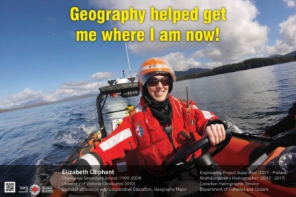
University of Victoria (Graduated 2010)
Bachelor of Science with Cooperative Education, Geography Major
Engineering Project Supervisor (2017 - Present)
Multidisciplinary Hydrographer (2010 - 2017)
Canadian Hydrographic Service
Department of Fisheries and Oceans
I was very interested in physical and social geography during high school. After graduating from Chemainus Secondary, I pursued my passion for geography at the University of Victoria and focused on geographic information systems, field surveying, cartography, and remote sensing. My studies exposed me to diverse topics and taught me the skills that I use every day.
During my post-secondary education, I participated in the cooperative education program. This gave me the opportunity to try a wide variety of work. I completed 4 student placements and my jobs ranged from being a whale watching interpretive guide, a geomatics technician, a data entry technician, and a surveying assistant. I described the flora and fauna of BC to tourists, digitized coastline, summarized lake survey documents, and surveyed municipal infrastructure. My co-op work experience is directly responsible for my success securing employment after graduation.
I work for the Canadian Hydrographic Service (CHS) and I have been with the organization for the past 8 years. Our mandate is to ensure the safety of Canadian navigable waterways through measuring and describing the physical features of the marine environment, including water depth, rocks, wrecks, and hazards to navigation with the goals of safe marine navigation, a prosperous marine economy, and environmental protection. We produce navigational publications, nautical charts, tide tables, and we monitor water levels for the tsunami warning system.
I started with CHS as a Multidisciplinary Hydrographer in 2010. I spent 5 years in a Professional Development Apprenticeship Program. This program involved working in: data acquisition and field surveying, chart production, and tides. Highlights included: extensively travelling the BC coast onboard ships, spending 2 summers surveying in Haida Gwaii collaborating with Parks Canada for habitat mapping, driving a zodiac at the Canadian Coast Guard school in Bamfield, scuba diving to deploy tide gauge instruments, and learning to drive a forklift.
Currently, I am an Engineering Project Supervisor in the Navigational Products and Services Division at CHS. I am responsible for project management and supervision of the Chart Production work unit. I use computer based mapping software to analyze geospatial information, manipulate data, view satellite imagery, and quality control paper and electronic navigation products before they are released to the public. I love that I get to use geography skills in my career.