
JANE KAISER
 Chemainus Secondary School
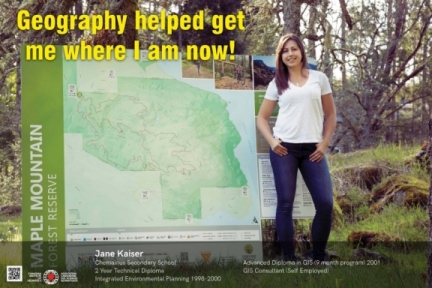
2 year Technical Diploma -
Integrated Environmental Planning 1998-2000
Advanced Diploma in GIS (9 month program) 2001
GIS Consultant (Self-Employed)
I was first exposed to Geographic Information Systems (GIS) in 1998 through requisite course work that was a part of the Integrated Environmental Planning program at Selkirk College. I entered this program after a year break from high school, and like many high school graduates I did not know what I wanted to do or who I wanted to be; I just knew I had to start somewhere. At that time, everything about computers was new to me; not only learning about GIS, but simple things like using email and browsing the internet. My first real-world independent GIS project came during my second year and involved GPS mapping the hiking and mountain biking trails for the Kootenay Trails Society and creating a trails kiosk map.
Following graduation from Selkirk College in 2000, I temporarily moved to Fort St. John for a summer job position as a “House Numbering Technician” with the Peace River Regional District (PRRD). In this position I used digital imagery (think google earth), the BC Assessment database and legal property descriptions, as well as field work to mark the geographic coordinates of house locations. These coordinates were then linked into a GIS database that formed the baseline data for 911 emergency response services in the Peace River Region. From Fort St. John, I went on to Vancouver where I was enrolled in the 9-month Advanced Diploma in GIS program at BCIT.
In the Spring of 2001 I graduated from BCIT and travelled North to Dawson Creek where I accepted a one-year contract with the PRRD as a “GIS Technician/Drafting Assistant”. In this position I was responsible for creating a cadastral data layer (legal lot lines) and then linking it to a parcels database that was used by Planners to search and map property information. When my year was up, I moved back to Vancouver Island and continued my GIS career in the Forestry sector. For the next 4 years I worked in Forestry creating maps to support cutblock planning, silviculture activities, streams management, wildlife habitat management and forest stewardship planning.
While working in Forestry, I was approached by a local environmental consulting firm to help out with some after hours mapping. This led to my next position with Madrone Environmental Services where I worked as a GIS Technician for 3 years. My position with Madrone opened up a whole new world of work that was better aligned with my background in environmental planning and my desire to have more creative freedom in my work. My duties at Madrone were expanded to include project management, field work, report writing and working within a team to complete small, medium and large scale environmental assessments. During my time at Madrone I managed three multi-faceted mapping projects including, Terrestrial Ecosystem Mapping of a proposed pipeline from Kitimat to Prince George, historical mapping of the Gulf Islands National Park Reserve and Terrestrial Ecosystem Mapping of the Coastal Douglas-fir biogeoclimatic zone.
After 7 years of working for private consultants, I wanted more freedom and control in my work life. In 2008 I left my position at Madrone and began my own GIS Consulting company that I still work at today. My first big project as a Consultant was working for SeaChange Marine Conservation Society to complete a detailed shoreline inventory for the coastline around the Saanich Peninsula and Saanich Inlet. This project involved designing a field plan, field form, collecting and inputting data, and completing data analyses and maps in support of a technical report. I spent 3 years working at Cowichan Tribes as a GIS mentor training their GIS Technician and managing their GIS data. I have completed numerous small mapping projects for property owners, Land Developers, Realtors and Biologists.
With 4 kids and a busy family life I have cut back on the amount of GIS work that I take on; however, I still work 6-12 hours a week on-site at the Municipality of North Cowichan. I began my work at North Cowichan on a contract basis for the Forestry department in 2009 and I have continued working there as a Contractor for 9 years managing the Forestry datasets, and more recently preparing maps for the Parks and Trails Department. I am currently working closely with the Parks department to map and sanction the hiking and mountain biking trails on Maple Mountain and Mt. Tzouhalem.
For me, the best thing about GIS is the fact that you aren’t limited by the field of work you choose; literally almost everything is mapped nowadays, and you can find jobs in many fields like emergency response, marine science, mining, oil and gas, ocean navigation and disaster management to name a few. In closing, I feel lucky to have stumbled onto this career that I have managed to work at for almost 2 decades; it has been a fulfilling and rewarding occupation.