GOUVERNANCE
EXÉCUTIVE
PRÉSIDENT  Dr Jonathan Li
Le Dr Jonathan Li est professeur de télédétection au Département de géographie et de gestion de environnementaleet au Département de génie de la conception des systèmes de l’Université de Waterloo. Il est titulaire depuis 2000 d’un doctorat en photogrammétrie et télédétection de l’University of Cape Town. Il déménagea au Canada après avoir travaillé en Chine, en Allemagne et en Afrique du Sud. Il est membre fondateur du Centre interdisciplinaire sur les changements climatiques et de l’Institut d’intelligence artificielle de Waterloo, et directeur fondateur du laboratoire de détection géospatiale et d’intelligence des données de l’Université de Waterloo. Les recherches du Dr Li sont consacrées à la cartographie géospatiale et à la télédétection urbaine à l’aide d’images d’observation de la Terre et de nuages de points LiDAR avec un impact significatif sur l’industrie de la géomatique. Il a supervisé plus de 100 thèses de doctorat, de maîtrise et de doctorat spécialisé jusqu'à leur achèvement. Dr Li a co-écrit plus de 250 articles de recherche publiés dans les prestigieuses revues en télédétection de l’IEEE, la SIPT, et Elsevier ayant un nombre élevé de citation du Google Scholar citations et ResearchGate citations En 2001, il a joint l’Association canadienne des sciences géomatiques (CIG/ACSG), Il siège au Comité National canadien de la SIPT depuis 2002. Il a été élu vice-président de l’ACSG lors de la 113e Assemblée générale du 27 octobre 2020. Il siège également au comité de certification de l’ACSG et il est rédacteur en chef adjoint de GEOMATICA dans le domaine de la télédétection En outre, il a servi comme président / coprésident de plusieurs groupes de travail de la SIPT depuis 2004 et comme président / vice-président de la Commission de l’ACI depuis 2008. Dr Li est rédacteur adjoint du IEEE Transactions on Geoscience and Remote Sensing, du IEEE Transactions on Intelligent Transportation Systems, du Journal canadien de télédétection, et membre du comité de rédaction du International Journal of Cartography. Le Dr Li est récipiendaire de plus de 20 prix prestigieux d’organisations internationales et nationales au Canada, aux États-Unis, en Chine et au Royaume-Uni, y compris le prix Outstanding Achievement in Mobile Mapping Technology Awards en 2019 pour ses contributions novatrices dans le développement et la promotion de la technologie de cartographie LiDAR mobile et reçu en 2020 le Prix Samuel Gamble pour ses contributions significatives au développement, à l’organisation ou aux activités professionnelles de la photogrammétrie, de la télédétection et des sciences de l’information spatiale au niveau national ou international. | PRÉSIDENT ÉLU
Dr Yang Gao
Dr. Yang Gao is currently a Professor in Department of Geomatics Engineering at the University of Calgary (UC). Prior to joining UC as an Assistant Professor in 1998, his career comprised periods in government and industry sectors, including Natural Resources Canada (NRCan) where he was a NSERC post-doc fellow and Pulsearch Navigation Systems Inc. and Position Inc where he held positions of Research Scientist, Manager of GPS R&D and Manager of Asia-Pacific. Dr. Gao’s research interests focus on the theoretical and practical aspects in global navigation satellite systems (GNSS) and integration with other enabling sensors. He is an author of over 350 technical publications and has a sustained record of success in project leadership with funding sponsored by government and private industries. He has advised and mentored more than 100 HQPs (50+ PhD/MSc students, 20+ visiting PhD students, 20+ PDF and visiting scholars) as well as numerous undergraduate students. He is very active in technology transfer whose research results have been transferred to GNSS receiver manufacturers, system integrators and service providers, with direct impact on product development. Dr. Gao has provided many years of distinguished service to international society and professional community such as International Association of Geodesy (IAG), US Institute of Navigation (ION), International Federation of Surveyors (FIG). He has served as Editor/Associate Editor for a number of international journals including IEEE Transactions on Vehicular Technology, Journal of Geodesy, Sensors, Journal of Geodesy and Geoinformation Science, Journal of Geodesy and Geodynamics, etc. Dr. Gao’s academic and leadership contributions have been recognized by major national and international awards. He received the prestigious Thurlow Award from the ION for significant and sustained contributions and leadership in the development and application of Precise Point Positioning (PPP) and high-precision GNSS technology. He received the Research Excellence Award from the Association of Professional Engineers and Geoscientists of Alberta for conducting innovative research in engineering that has been successfully applied to improve economic and social well-being. He also received Intermap Award from the Canadian Institute of Geomatics (CIG). He is a Fellow of both ION and IAG. |
VICE PRÉSIDENT  Dr Naser El-Sheimy Dr. Naser El-Sheimy is Professor and former Head of the Department of Geomatics Engineering, the University of Calgary. He holds a Tier-I Canada Research Chair (CRC) in Geomatics Multi-sensor Systems. He is a Killam Professor, a Fellow of the Canadian Academy of Engineering (FCAE), a Fellow of the Engineering Institute of Canada (FEIC), and a Fellow of the US Institute of Navigation (FION). Dr. El-Sheimy is a leading authority in Geomatics multi-sensor systems and their applications in mapping and navigation systems. His research acumen is typified by the NSERC DAS Award (2 times), the ASTech award in Science and Technology and over 30 research awards from national and international bodies. He was founder and scientific director of TECTERRA CECR NCE and the founder of three spin-off companies. He has published 2 books, 500 papers, 4 software and holds 9 patents. He has received many teaching awards and has supervised 150 graduate students/PDFs that have obtained positions in industry, academia, and government. Dr. El-Sheimy has held many leadership positions, large-scale grants, and lead multi-PI programs. |

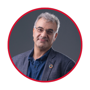
PRÉSIDENTE SORTANTE IMMÉDIATE  Dr Mir-Abolfazl Mostafavi
He is currently a member of the Centre for Research in Geospatial Data and Intelligence (CRDIG) and has acted as the Scientific Director of the centre for six years (2010–2016). In his research activities, Professor Mostafavi innovative research activities on geographic information systems (GIS), dynamic multidimensional GIS, spatial modelling, geosimulation, spatial ontologies and semantic interoperability, sensor networks for smart mobility and smart environments. Since 2009, Prof. Mostafavi has joined the Centre for Interdisciplinary Research in Rehabilitation and Social Integration (CIRRIS) allowing him to open a new horizon in innovative multidisciplinary research activities involving geospatial technologies to assist people with disabilities (PWD) and elderly people in their daily activities, and hence to contribute to improving their mobility, social participation and quality of life. Since early 2020 and,iIn collaboration with several researchers in CRDIG and CIRRIS, he has established his new research Lab “ Mobility Sensing Lab” where he works with his team on Mobile assistive technologies, wayfinding, personalized navigation technologies by putting emphasize on characterization of human-environment interactions and the development of a new generation of “platial information sciences and systems”. MobiliSIG is an example of multidisciplinary projects led by Dr. Mostafavi since 2014. In 2013 and following the end of the GEOIDE Network, Prof. Mostafavi led a team of more than 30 researchers from 11 universities across Québec and Canada to establish the Convergence Network on Geospatial Intelligence for Innovation (CONVERGENCE NETWORK).The network, which is funded by the Government of Québec (Programme d’appui aux réseaux d’innovation de FRQ-NT (2013-2019), aimed at facilitating collaborations and partnerships between academia, industry and government to undertake research and innovation in the field of geomatics and to accelerate knowledge transfer to potential users. In addition to the researchers, more than 22 provincial ministries and agencies, as well as several federal agencies and private companies, were members of the network. He joined the Canadian Institute of Geomatics (CIG) in 2004 and has been serving on the Canada’s National Committee for ISPRS since 2006. He was elected Vice President of CIG in October 2019 and as the President Elect of CIG in October 2020. Among his contributions to several international organizations in geomatics, Professor Mostafavi has been actively involved in the International Society of Photogrammetry and Remote Sensing (ISPRS) since 2004. He is currently co-chair of the international working group on Semantic Interoperability and Ontology for Geospatial Information within the ISPRS commission IV (WG IV/2). |
TRÉSORIER  Dr Azadeh Koohzare
With a track record of managing and overseeing 200+ geospatial projects during her 20+ years career, Dr. Koohzare brings unparalleled expertise in geospatial projects and LiDAR/airphoto surveys. As a division manager at McElhanney Ltd., she is a performance-driven leader who has successfully managed cross-functional teams. Her portfolio includes multi-year LiDAR and airphoto survey across Canada. Outside Canada, Azadeh is recognized for her work in South America, Africa, Middle East, and Southeast Asia. In addition to her tangible project successes, Azadeh’s innovative solutions developed for the industry has been presented and published in many journals and peered reviewed conferences |
TERRE-NEUVE ET LABRADOR  Desmond Power
 is Vice President of Remote Sensing at C-CORE and he manages a group of 50 individuals with expertise on geomatics, radar systems, earth observation and GIS. This groups represents one of the largest private sector organizations performing research and development in Canada on earth observation and geomatics. Desmond has over 30 years of professional experience, having started with C-CORE (St. John’s, NL) in 1991. In the first seven years of his career, he primarily worked on high frequency over the horizon radar. In 1998, he started work on microwave radar systems and satellite synthetic aperture radar. He has since branched out into work on earth observation (electro-optical and SAR) and geomatics, with a strong focus on research and applications development. The research performed by Desmond’s group includes iceberg and vessel detection, SAR-based winds, EO water quality and river ice monitoring, ice charting and sea ice thickness measurement, satellite and ground-based interferometric SAR (for ground deformation monitoring), vehicle detection and monitoring, wetlands monitoring and oil slick detection. To date, his group has completed several hundred individual projects on various applications of remote sensing and geomatics. In addition to Desmond’s work with CIG, he is an member at large of the executive of Canadian Remote Sensing Society, a member of the Institute of Electrical and Electronics Engineers and a P.Eng registered with Professional Engineers and Geoscientists of Newfoundland and Labrador. Desmond holds a Bachelor and Master of Engineering Degrees from Memorial University of Newfoundland.
| NOUVEAU-BRUNSWICK
| CHAMPLAIN  Philippe Dion Philippe est diplômé en génie géomatique. Il a une vaste expérience de plus de 15 ans en consultation géospatiale et architecture de solutions géospatiales. Chez Korem, Philippe occupe un rôle hybride alliant le développement de cartographie et d’intégration web ainsi que l’analyse géospatiale. Il agit comme lead architecte à l’intégration de fonctions et de solutions géospatiales personnalisées qui répondent aux besoins d’affaires des clients. Il a travaillé auparavant chez CGI et la SOPFEU toujours dans le domaine de la géomatique. Philippe est membre de l'ACSG Section Champlain depuis plus de 10 ans et a occupé des postes d'administrateur et de trésorerie. Il a toujours été proactifs pour l'organisation d'activités de réseautage dans la grande région de Québec dans le but de garder la communauté géospatiale vivante. | MONTRÉAL  Martin Carpentier Stratège, gestionnaire et administrateur aguerri, Martin a d’abord évolué dans le milieu politique pendant une vingtaine d’années. Il a été, entre autres, directeur des opérations au Cabinet de la première Ministre du Québec. Il a aussi mis sur pied et dirigé son entreprise de production et gestion d’événements ainsi que de services-conseils. Martin a aussi développé une expertise dans le domaine des villes intelligentes et des technologies innovantes depuis les dix dernières années, entre autres à titre de directeur du développement des affaires pour des PME. Il s’intéresse à tout ce qui touche les nouvelles technologies et peut compter sur un vaste réseau de contacts. |

OTTAWA 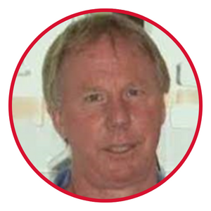 John Donner
, PEng., is an employee of Natural Resources Canada working at the Centre for Topographic Information in Ottawa as a project manager. He is a graduate of the Geodetic Sciences program (1979) Ryerson Polytechnical Institute, and a graduate of the Surveying Engineering program (1984) at the University of New Brunswick. John has been a member of both the Toronto and Ottawa Branches of CIG and has been on the Ottawa Branch Executive since 1990. He is currently the Chair of the Ottawa Branch and was previously the Chair of the Branch from 1994 to 1997. | TORONTO
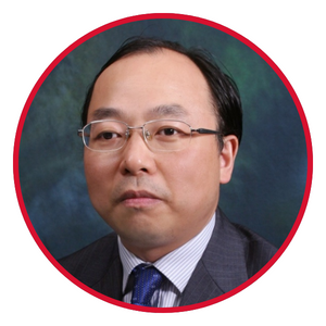
Gunho Sohn | COLOMBIE-BRITANNIQUE | CALGARY
Ronald Ramsaran is currently the Director of FAE at Trusted Positioning Inc, a TDK company. A proud graduate of the University of New Brunswick for his undergraduate degree in Geomatics, and the University of Calgary for his Masters in Positioning and Navigation, Ronald was inspired to pursue a career in Geomatics after work in the field at Syncrude Canada overseeing their implementation of GPS back in the late eighties. Prior to working at Trusted Positioning Inc., he was the Director of at CHC Navigation, responsible for developing and designing GNSS products for the North America markets. Ronald also held several key positions at Hemisphere GNSS, a local GNSS manufacturer in Calgary. With thirty years of experience in GNSS hardware and applications development within medium to large scale organizations he is progressively growing his engineering career. His ability to navigate through challenges, coupled with his attention for detail, has earned him a reputation for fostering collaboration with his customers for achieving successful project implementation. Ron’s proven track record in overseeing the entire project lifecycle, from a customer’s idea to a commercial product, he has managed projects ranging from hardware development to large-scale infrastructure implementations both on land and marine. He believes in aligning project objectives with organizational strategies, for overall product deliverable that contributes to the success of the business. A self-motivated communicator with a strong comprehensive knowledge of executing company goals, Ronald can help motivate and inspire others by fostering an environment for innovation and teamwork. He possesses positive work ethics and aptitude for strategically formulating solutions that allow him to overcome any challenges that arise from the job. Today Ronald continues with his passion in Geomatics working together with his amazing colleagues at Trusted Positioning Inc, developing products for addressing positioning requirements for Indoor tracking and autonomous vehicle applications. |

ÉTUDIANTS
Lanying Wang is a PhD Candidate of remote sensing at the Department of Geography and Environment Management, University of Waterloo. She received the B.Sc and M.Sc in Geomatics from the Tianjin Normal University, China, and the University of the Waterloo, Canada, respectively. She worked with the Geomatics R&D industry for more than 7 years. In addition, she has served as a chair/co-chair of IEEE International Geoscience and Remote Sensing Symposium (IGARSS) since 2020. Her current research interests include developing software and cloud-based applications of LiDAR point cloud and earth observation imagery by using deep learning techniques. | OUTRE-MER
Professor Saeid Pirasteh collected 24 years of experience in research, development, teaching, administration, management, leadership, social engagement, and supervision at various universities and industries in various countries. His research interests include Geospatial Data Science & GeoAI, Remote Sensing Computer Vision (satellite, drone, LiDAR) and data processing, GIS and Geospatial Information analysis and modelling and developing algorithms for their novel applications in hazards & disasters beyond.
| HONG KONG
George Zhi-zhao Liu
Dr. George Zhizhao Liu currently is a professor at the Department of Land Surveying and Geo-Informatics, The Hong Kong Polytechnic University, Hong Kong, China. Professor Liu's Micro-Laboratory of Atmospheric Research and Geomatics Engineering (Micro-LARGE) has made significant contributions to the community through unique developments and innovations in various areas, including GPS/GNSS precise positioning algorithms and data quality analysis, ionosphere scintillation monitoring and 3D TEC modeling, impact of space weather on satellite navigation and flight operation, monitoring of atmospheric water vapor and 3D modeling, retrieval and calibration of satellite remote sensing water vapor data, and assimilation of atmospheric water vapor in Numerical Weather Prediction (NWP) models.
His Micro-LARGE Lab was the first one internationally to study and evaluate the impact of space weather on flight operation from an economic cost perspective and propose response strategies, which was highly commended by senior scientist at the NASA JPL and was selected as a research highlight in the Nature Reviews Earth & Environment Journal (IF: 42.1). Multiple algorithms developed by the Micro-LARGE for GNSS data processing have been widely used by research groups of many universities, research institutions and industries worldwide. Prof. Liu’s Lab is also the first one in the world to both calibrate and assimilate all-weather (including cloudy condition) near-infrared (NIR) band satellite remote sensing water vapor data into NWP. Over the years, he and his students have won numerous prestigious awards and scholarships, including the inaugural “Early Career Award of the Hong Kong Research Grants Council (RGC)” in 2012, the “Zhu Kezhen” Prize from the Hong Kong Meteorological Society, and many others. He has been serving a reviewer for Australian Research Council (ARC) grants, Canadian NSERC Strategic Project grants, Canadian Mitacs Elevate Postdoctoral Fellowship, Chinese NSFC grants, EU Horizon 2020 grants, and many SCI journals. He has been a Task Team Member of GNSS Precipitable Water (GNSS-PW) Task since 2012 under the Global Climate Observing System (GCOS) Reference Upper Air Network (GRUAN), a joint undertaking of the World Meteorological Organization (WMO), the Intergovernmental Oceanographic Commission (IOC) of UNESCO, the United Nations Environment Programme (UNEP), and the International Council for Science (ICSU). He got his BSc degree from Jiangxi University of Science and Technology, China, in 1994; MSc degree from Wuhan University, China, in 1997; and PhD degree from the University of Calgary, Canada, in 2004. |

PHOTOGRAMMETRIE 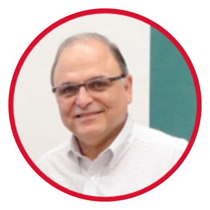 Costas Armenakis
 (Dipl Ing, MScE, PhD) is an Associate Professor of the Geomatics Engineering program, Department of Earth and Space Science and Engineering, York University. Prior joining York University he was a Research Scientist with Natural Resources Canada (NRCan). His research interests are in the areas of photogrammetric engineering and remote sensing mapping including robotic mapping using cost-effective unmanned vehicle systems, 3D mapping and tracking using image-sequences, 3D modelling using optical and lidar data and the integration of GIS and remote sensing methods and data for risk assessment and emergency response. He is an ISPRS Fellow and has served as President of the ISPRS Technical Commission IV on Digital Mapping and GeoDatabases (2000-2004). Currently he is Co-Chair of the ISPRS ICWG I/Vb Unmanned Vehicle Systems (UVS): Sensors and Applications. He is a Professional Engineer registered in the Province of Ontario and member of the Canadian Institute of Geomatics (CIG) and the American Society of Photogrammetry and Remote Sensing (ASPRS).
| CARTOGRAPHIE & CNC ICA
Dr Julia Siemer
Dr. Julia Siemer is an Associate Professor of Cartography and Geographic Information Science with the Department of Geography and Environmental Studies at the University of Regina, Saskatchewan, Canada. Before joining the University of Regina, she has held positions as cartographer in publishing houses in Germany and Switzerland and has been the map editor and chief cartographer of the GIS-based Demographic Atlas of Albania, a research project in the scope of the Stability Pact for South Eastern Europe by the German Exchange Service (DAAD). She has taught undergraduate and graduate courses in cartography, GIS, and geography at University of Regina, University of Potsdam and University of Applied Sciences Berlin, Germany. Dr. Siemer has been the president of the Canadian Cartographic Association (CCA) from 2016 to 2018. Her current research interests include cartographic visualization of population distribution and their characteristics, spatial analysis and visualization of food accessibility, atlas cartography, and thematic mapping techniques. |
COMITÉ DES PRIX  Tommy St-Denis
Mon nom est Tommy, j'ai un baccalauréat en sciences géomatique et je
travaille pour la firme Géolocation à Québec en tant que chargé de
production pour l'unité d'arpentage et de géomatique. Je suis également
président de la branche Champlain de l'ACSG. En dehors du boulot, mes
champs d'intérêts sont très diversifiés, particulièrement pour les
sports et activités extérieures telles que le ski, la pêche et la course
à pieds.
| COMITÉ DE NOMINATION |

CNC-FIG
Dr. Francis Roy | CERTIFICATION
Yaïves Ferland | COMITÉ DES MEMBRES
| COMITÉ DES PUBLICATIONS
Dr Yuhong He Dr. Yuhong He is a Professor in the Department of Geography, Geomatics and Environment (GGE) at the University of Toronto, Mississauga Campus (UTM). She received her Ph.D. in geography from the University of Saskatchewan (2008) and joined UTM in 2009. Her research employs remote sensing, machine learning, and ecosystem modelling to study changes in natural (grasslands, forests, wetlands) or managed (farmlands and urban) systems. Dr. He has received significant funding from internal and external sources to support her work. She has mobilized multidisciplinary researchers and collaborated with cross-sectoral practitioners for the common goals of understanding how human activities and global changes affect environments and discovering how to make our natural/built environments healthier, more resilient, and adaptable. With over 90 peer-reviewed journal articles and 100 conference papers, Dr. He and her team have made substantial contributions to the remote sensing field. Her former students have also successfully pursued remote sensing careers in academics, government, and industry. She has received several prestigious awards, including the Early Career Scholar Award from the Remote Sensing Specialty Group at the 2011 AAG annual conference, the Early Researcher Award of Ontario in 2015, the E. A. Robinson Teaching Excellence Award of UTM in 2017, and the Desmond Morton Research Excellence Award of UTM in 2022. Dr. He has actively served in editorial roles, including being the Editor-in-Chief of Geomatica, Associate Editor for the ISPRS Journal of Photogrammetry and Remote Sensing, and Remote Sensing. Additionally, she was an Associate Editor for the Journal of Applied Remote Sensing from 2016 to 2019. Dr. He has been a member of the editorial advisory board for several journals, including the ISPRS Journal of Photogrammetry and Remote Sensing, Environment Management, and the International Journal of Applied Earth Observation and Geoinformation. Currently, Dr. He serves as the Director of the Canadian Remote Sensing Society (CRSS) and the Co-Chair of Working Group 4 (the Award Group) in CRSS. Her previous service includes roles as the Director of the Remote Sensing Specialty Group in AAG (2012-2014), Department Chair (2018-2023), Associate Chair, Academic (2017), and GIS program advisor in GGE at UTM. Throughout her career, Dr. He has fostered extensive interdisciplinary research collaborations, working with partners from local conservation authorities (e.g., Credit Valley Conservation, Toronto and Region Conservation Authority), federal government organizations (e.g., Agriculture and Agri-Food Canada, Natural Resources Canada), and private companies (e.g., The Ontario Aggregate Resources Corporation, Hydro One). |


GÉODÉSIE 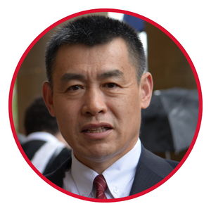 Dr Jianguo Wang
Dr.-Ing. Jianguo Wang is a Professor of Geomatics Science and Engineering at the Department of Earth and Space Science and Engineering of Lassonde School of Engineering, York University. He is a licensed Professional Engineer at PEO in Ontario and also entitled to Fellow of Canada Engineers (FEC). He received his Dr.-Ing. in Surveying Engineering from the Universität der Bundeswehr München in 1997. Prior to this, he obtained his B.Eng. and M. Eng. in Surveying Engineering from WTUSM (Wuhan Technical University of Surveying and Mapping, merged with Wuhan University in 2000) in 1980s. He had more than 40 years academic and industry work experience in China, Germany, and Canada. He was assistant lecturer, lecturer at WTUSM from 1982 to 1992 and was employed at Applanix from 1999 to 2006 as Navigation Engineer. In 2006, he moved to York University. Dr.-Ing. Wang’s research is devoted to the modern Direct-Georeferencing Technology (i.e., multisensor-integrated kinematic positioning and navigation). He has been supervising or co-supervising PhD, MSc and Honours theses in Geomatics. He has co-authored over 65 peer reviewed journal papers and book chapters, 20 conference papers, and co-authored textbooks: Foundation of Geodesy and Engineering Surveying, and led the English edition of the textbook of Error Theory and Foundation of Surveying Adjustment. Since his tenure at York University, he has been teaching more than 12 different subjects including (undergraduate) Fundamentals of Surveying, Field Surveys, Geodetic Concepts, Geodetic Surveys, Advanced Field Surveys, Adjustment Calculus, Analysis of Overdetermined Systems, GNSS, Global Geophysics and Geodesy, Hydrography, (graduate) Advanced Optimization Methods and Applications, and Advanced Satellite Positioning etc. He also co-chaired the 7th CPGPS Forum on Multisensor Integrated Positioning and Navigation in 2015. In addition, he was a member of the editorial Board of Journal of Global Positioning Systems and has been serving as Editor-In-Chief of Journal of Global Positioning Systems since 2020. He joined the Canadian Institute of Geomatics (CIG) in 2010 and chaired the Local Organizing Committee of the Joint 2013 CIG Annual Conference & the 2013 International Conference on Earth Observation for Global Changes, and served the Organizing Committee of Joint 2007 CIG & ISPRS Conference on Geomatics for Disaster and Risk Management. He also served as a member of Task Force for Major Syllabus Review of Canadian Council of Land Surveys in the late 2000s and a member of the CBEPS TOLD AEP (Academic Exemption Process) Committee from 2019 to 2022. Besides, he has been serving as a member of PEO Experience Requirements Committee since 2009. | CADASTRE  Daniel Roberge | HYDROSPATIAL  Denis Hains | ICC 25
Emmanuel Stefanakis
Emmanuel Stefanakis, PhD, PEng, serves as a Professor and the Head of the Geomatics Engineering Department at the University of Calgary. He has held the position of Editor-in-Chief of the Cartographica Journal and received the 2023 Award of Distinction for Exceptional Scholarly Contributions to Cartography from the Canadian Cartographic Association. He is a member of several professional organizations, including the Association of Professional Engineers and Geoscientists of Alberta (APEGA), the Canadian Institute of Geomatics (CIG), and the Canadian Cartographic Association (CCA). Additionally, he is actively involved with the Canadian Board of Examiners for Professional Surveyors (CBEPS) and the International Society for Photogrammetry and Remote Sensing (ISPRS). |